The Rathaus is two buildings stuck together. The older Gothic range behind, with the tower, is 13th century; the front burned at the start of the 16th century — the town gives 1501 — and was replaced between 1572 and 1578 by the Renaissance range you see from the square, with the Baroque arcade added in 1681. The tower stands 60 metres. Rothenburg had been a free imperial city since 15 May 1274, answering to the emperor and no local lord, and this is the building that says so.
The climb is 220 steps to the viewing platform, and it is not a gentle staircase: the stone stair gives way to narrow wooden flights, the town’s own material calls the ascent steep and narrow, and the platform is a small open gallery. Expect to stand aside for people coming down. There is no lift.
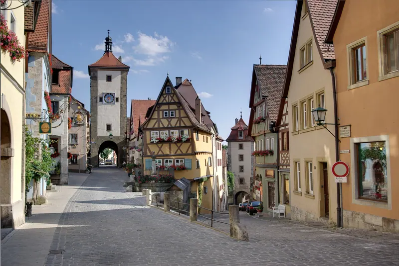
What you get for it is the plan of the town. From up here the four-kilometre wall reads as a single shape with its gate towers spaced along it — Rödertor east, Klingentor north with St Wolfgang’s church built into it, Spitalbastei to the south — and beyond it the Tauber valley and the Frankenhöhe. Look south along the roofline of the Untere Schmiedgasse: the tall tower closing the lane is the Siebersturm, the gate dropping away below it is the Kobolzeller Tor, and the fork between them is the Plönlein, which from here is a street junction rather than a postcard.
It is also the best place in town to understand 31 March 1945. The quarter east of you, toward the Rödertor, is where the incendiaries fell: around 40% of the inner town burned, and what stands there now is reconstruction of 1945–56. The street lines and the plot widths are medieval; the roofs over them are not. At ground level the join is invisible, which is the whole achievement of the rebuild — and also the reason it is worth knowing from up here.